As you know, in the late 17th/early 18th century Vauban was the fortress builder of Louis XIV and he was building all kinds of fortresses on the borders of France to protect the realm of the Sun King.
One of the cities which he fortified was Breisach which lies on the eastern (German) side of the Rhine.
But at the Peace of Rijswick (1697), which ended the Nine Years War (also called the War of the League of Augsburg), Breisach came in the posession of the Emperor. So a part of the French Rhine frontier was undefended.
Louis ordered Vauban to build a new fortress, but now on the western side of the Rhine.
Work was started in 1699 and finished in 1703. The fortress (or better a fortified town) was build as the master piece of the art of Vauban.
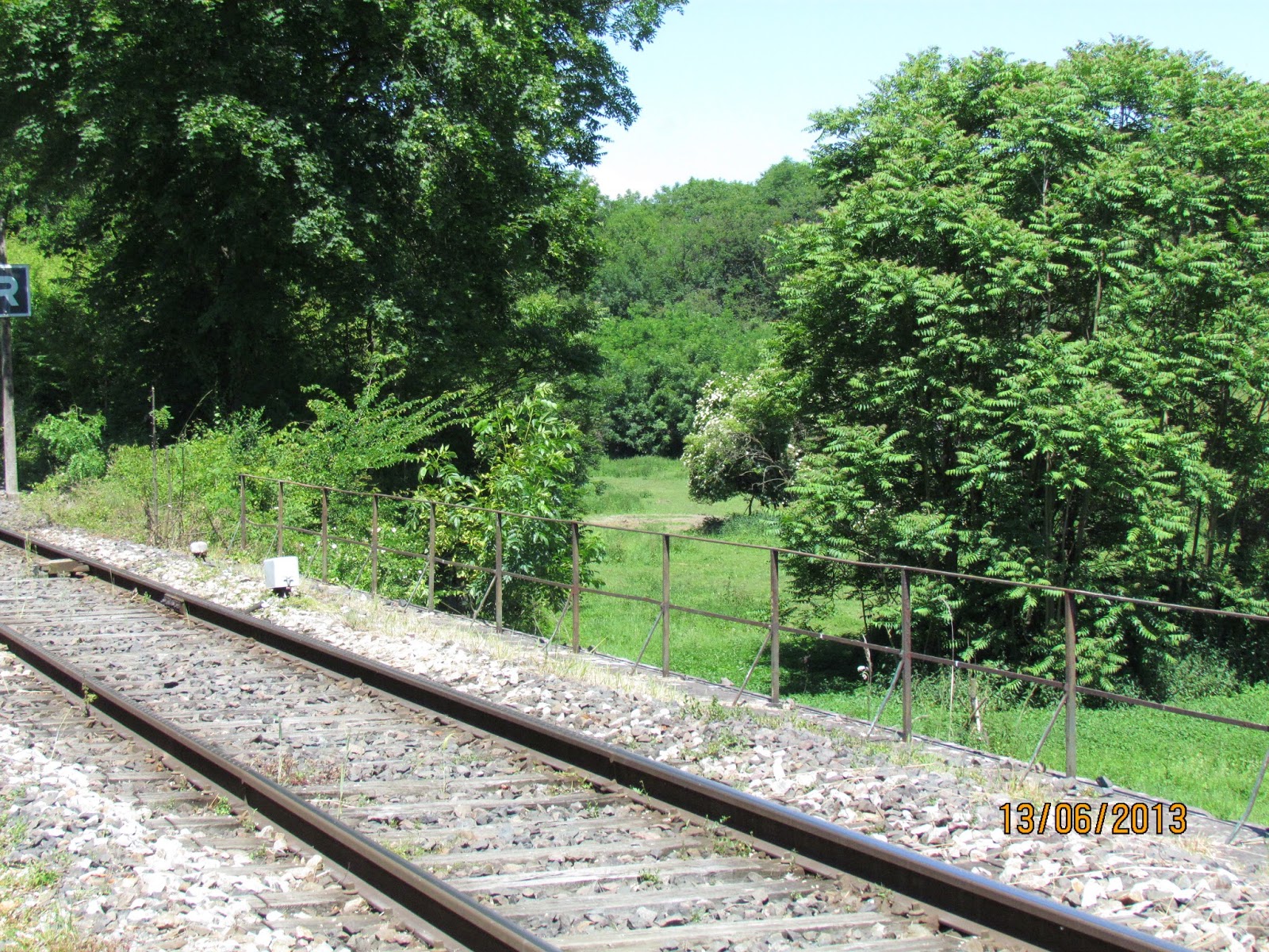
Neuf-Brisach was besieged in 1743 but not taken. In the Franco-Prussian it again was beseiged and taken by Prussian troops and its walls partly destroyed as was one of the gates. A raillroad was built partly through the defenses but other damages were rebuilt and it is today almost the same as 300 years ago.
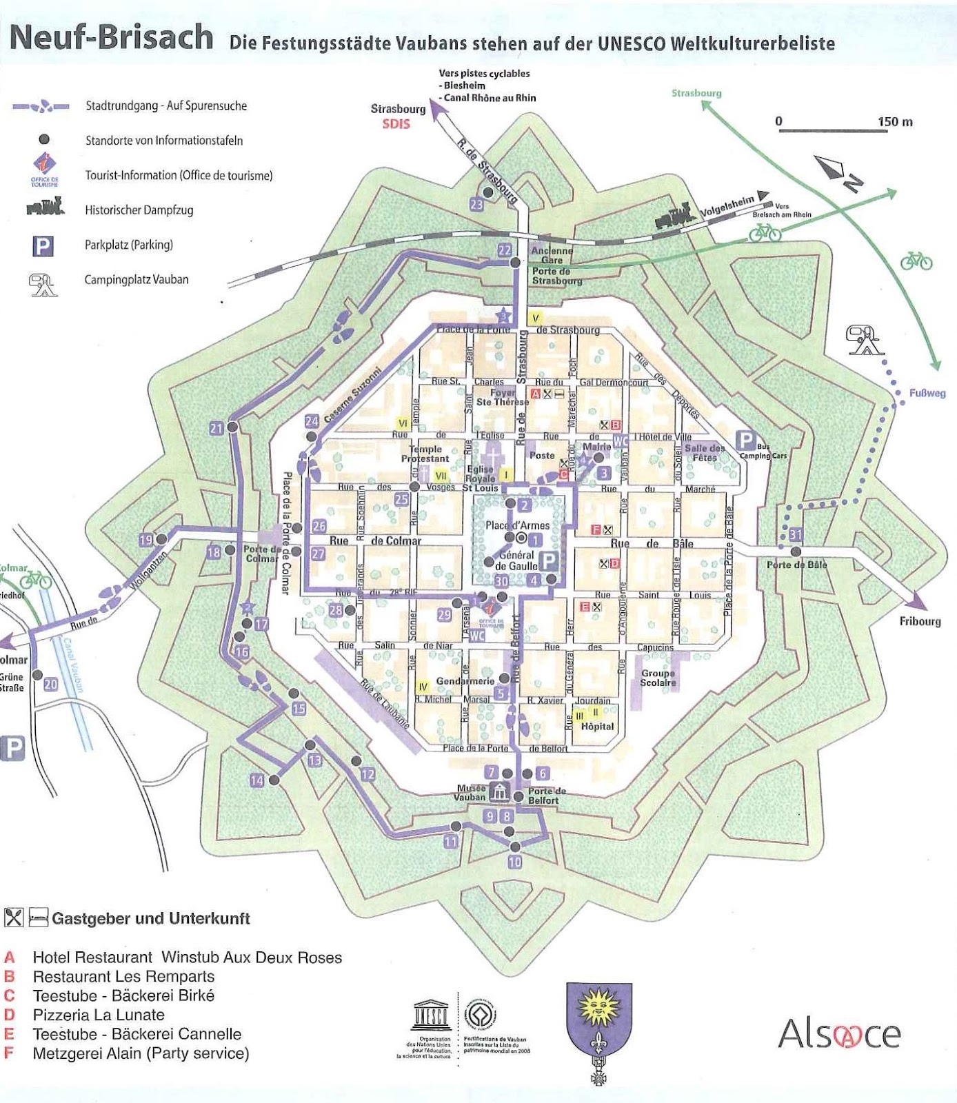
So when I was there on holiday I visited the city and took pictures. The map shows the outline of the fortress and I will try to add to the photos to (most of) these points so you have a better representation.
1. Place d'armes and the fountain. The church in the background is not from this period but a later period building.
7. Walking from the Place d'armes to the musee Vauban which was the Porte de Belfort. The plaque is on the museum wall.
9. Looking through the Porte de Belfort. To the left and right the doors to the museum-closed 12.00 to 14.00 hours. .
At the back the exit to the dry moat from which you have the following sight:

In the foreground the stairs leading to the moat while in the moat a iron boat which was used in 1842 to transport stones.
10. in the moat and when looking over your shoulder you see the Porte de Belfort and the stairs leasing to the museum
10. When climbing 10 you get a better impression of the Porte de Belfort and the riverboat
10. The sight from 10 outwards to the outerworks; view to the right
and to the left
from 10 to 13. Walking through the moat

nr 13, through the wall
13. When through the wall you can climb on the wall and see in front the bastion nr 14
13. and back again in the moat; in the background the passage to nr 15
16. On the right background the small bastion of the main wall
18. And after a small walk the bridge of the Porte de Colmar
22. The bridge leading to the Porte de Strassbourg on the northern side
On this part through the defenses a railroad was build
22. The porte de Strassbourg was destroyed in the 1870 Franco-Prussian War and never rebuild in the old fashion.
And here end the short description of our walk through Neuf Breisach.


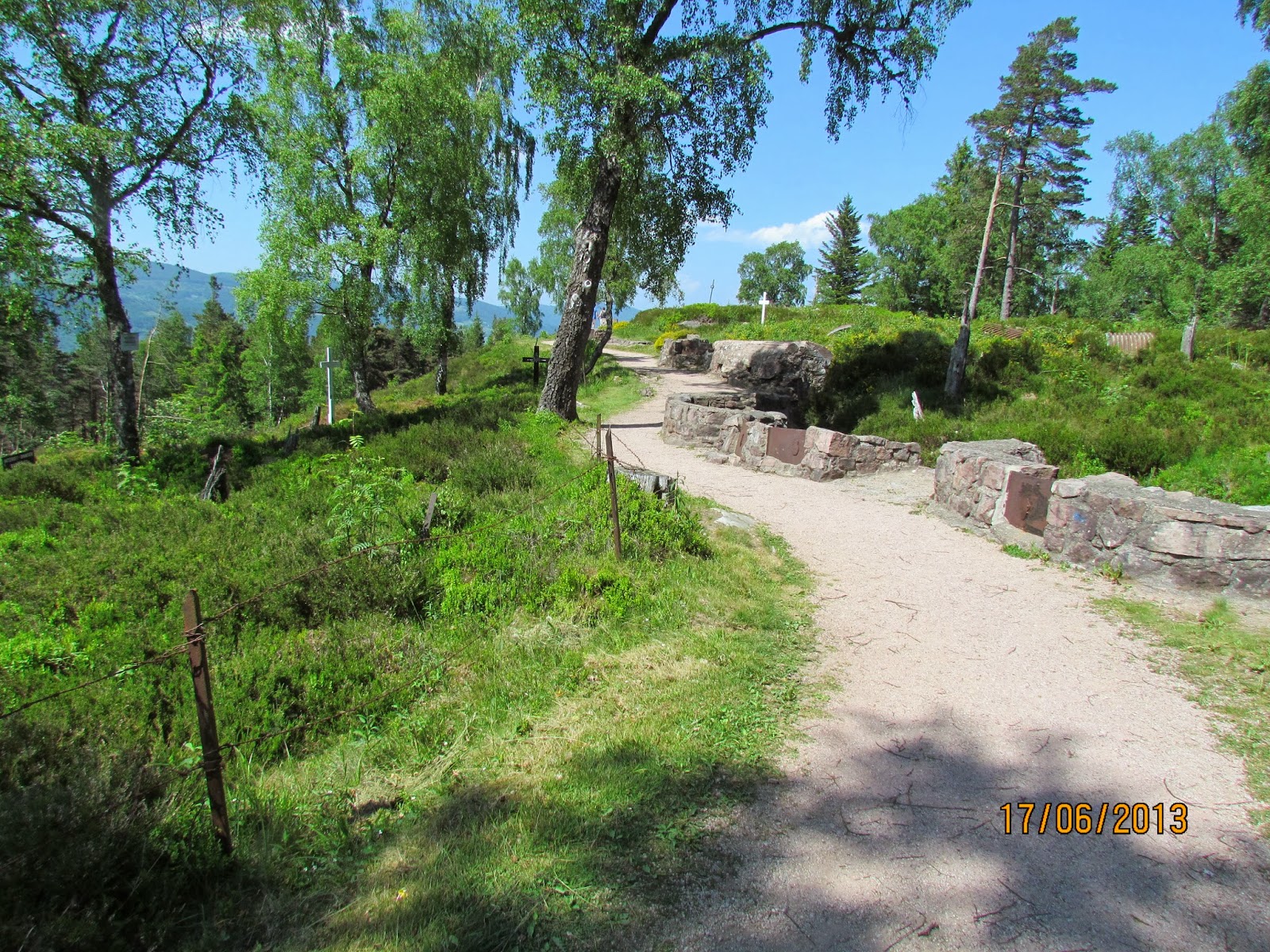
 The military road which was build by the French on their side of the mountains still exists today (called: Route des Cretes) and is on this moment a tourist highpoint on which you see the beautifull landscape of the Alsace But it also runs along the battlefield and cemetaries of that period.